 |
 |
 |
|
|
|
|
 |
If this facade looks familiar, it might be that you've seen
it, in the movie "Indiana Jones and the Last Crusade," which was filmed at
this ancient city of Petra in Jordan, not far from the Israeli border.
Petra was in its prime during the same period that Alexander the Great was conquering the rest of the Mediterranean. Its inhabitants, the Nabataeans, were traders along the silk route. Though their empire might have stretched from Yemen to Damascus and from Iraq into the Sinai Desert, we know very little about them, as they didn't leave a written record behind. We know that they worshiped a male deity and a fertility goddess, and probably some Hellenistic and Egyptian deities as well. |
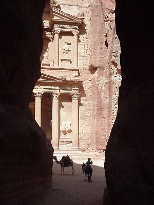
| Canyons like the one at right protected Petra
from outsiders. Some are about 100 meters (300 feet) high, and the sandstone
rock has oxidized into a pinkish hue that has given Petra the name "The
Rose-Red City."
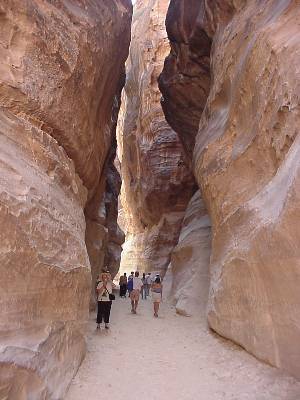
Alongside this canyon, also called the "siq", the Nabataeans carved tombs, facades, and reliefs into the rock. The canyon itself is more than a kilometer long. Niches carved into the stone once held statues. In an eroded carving, we could see the outlines of men walking alongside their camel caravan. The ground was paved, and there are still traces of the ruts made by chariots and wagons in places where the cobblestones are still intact. |
 |
|
|
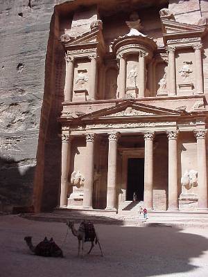
This building is called the Treasury, though it was probably
never anything but a tomb. It got its name from a stone urn high in the
facade. It must have fooled the local Bedouins, too, because for many years
they tried to open the urn's treasures by shooting bullets into it. Later
excavations demonstrated once and for all that inside the stone urn was
simply solid stone.
Though the Treasury, or Al Khazneh, might have served as a place to hide treasure, this was probably the tomb of Nabataean King Harith IV, or a temple to the goddess Isis, though there isn't much proof for any particular function for this building. |
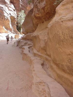
| The Nabataeans were experts at water
management, collecting and storing water by using aqueducts, clay water
pipes and cisterns, using waterproof cement, some of which is still intact
today. Here is an example of a channel that runs the length of the canyon,
providing water to the town. They collected water from flash floods during
the rainy season, and kept the water source a secret from their enemies.
Apparently, the Romans, who had been unsuccessful at conquering Petra for some years, finally captured a resident of the Petra community, and the prisoner told them of the springs that fed Petra, enabling the Romans to conquer the town in 106 AD. |
 |
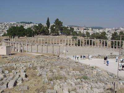 |
One of the reasons for Petra's decline after its capture by the Romans was that the Romans had their own idea where trade routes should be, and Petra wasn't it. They set up a federation of ten cities, called the decapolis, (or, yes, ten cities, in Greek) to manage international and regional trade. Well north of Petra in Jordan, we visited the best-preserved of these cities, Jerash. Though only fifteen percent of Jerash has been excavated, there is a good deal to see there, including this oval plaza surrounded by fifty-six of the original hundred Ionic columns. |