 |
 |
 |
|
|
|
|
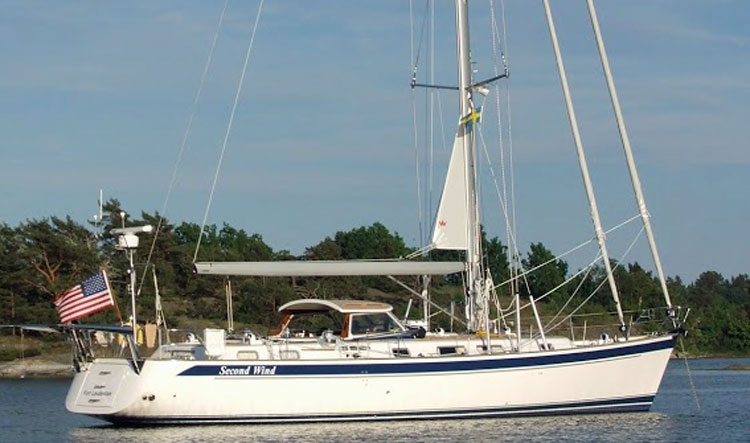
Since we began sailing decades ago, the technologies associated with navigation have improved dramatically. Electronic instruments are invaluable for determining your location, the location of your destination, and whether there are obstructions and other boats around you. Some now connect to a PC and a telephone, which makes the Internet available, too.
|
|
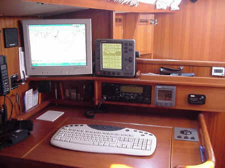
Here is the navigation station of Swept Away. From left to right, you can see the hands-free GSM mobile phone (connected to an antenna outside to improve transmission), the VHF transmitter/receiver, and our PC, which we use for viewing electronic charts, when we have them, or retrieving weather forecasts from a variety of sources. Continuing to the right, there is a radar/chart plotter displaying some databoxes, below it, a single sideband radio (SSB), a single "multi" instrument to show us depth, speed or dozens of other data items, and the last item, a clock always tuned to Greenwich Mean Time, a necessity for navigation. Software on the PC includes a program that exchanges data with the onboard instruments, using weather information from the Internet, and plotting all of the data on a navigational chart. We also use the PC to retrieve other, local weather information from the Internet, or connect to services through SSB for Telex or Navtex. We can retrieve weather fax information from either SSB or the Internet. |
|
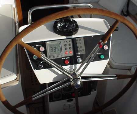
At the wheel, the autopilot's screen dominates the instrumentation on the pedestal. The screen offers yet another display of any of the information available from the instruments. The helmsman can also switch the cockpit instruments under the dodger remotely to display new information. |
|
|
|
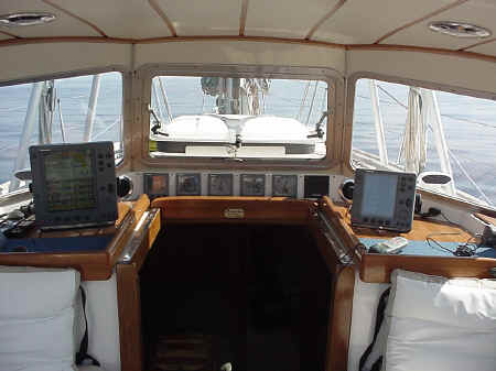
Much of our offshore time is spent here, under the protective dodger, so it's important to have access to navigational data. There is a repeater radar/plotter unit, displays for boat speed, depth, the wind direction relative to the boat, another all-purpose multi unit, and a close-hauled expanded wind meter when the wind is in front of us and single degrees of wind angle can affect the boat's performance. At right, we keep the second radar/plotter configured to display more data items measured or calculated by the system. The GPS (global positioning system) on board doesn't merit its own instrument, but its presence is needed for data items such as "distance to the waypoint (destination)" or "speed towards the waypoint." At far right is a remote device that lets us adjust the autopilot's course and view its data without having to leave the protection of the dodger. |